The Railway Walk
The Teesdale Railway track provides a great walk from Cotherstone to Middleton, in three easy sections. It is fenced, making it ideal for dog walkers. Download a PDF of the Railway Walk Guide.

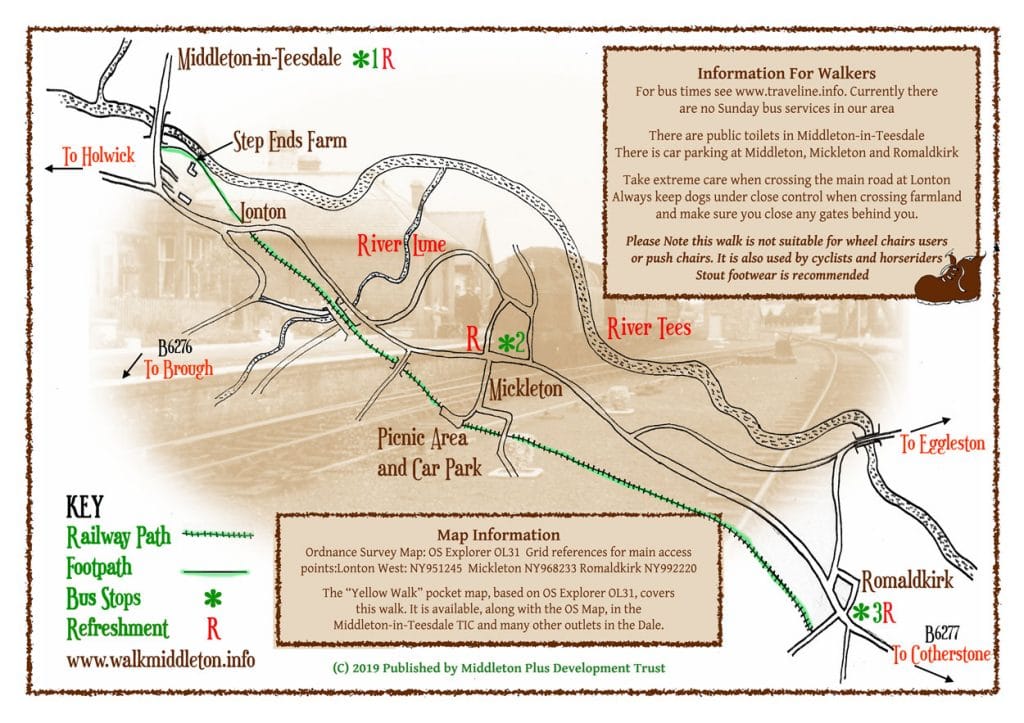
From Middleton-in-Teesdale take Bridge Street (B6277) and cross the County Bridge over the River Tees, follow a finger post on the south side of the bridge using a small wooden gate. Descend the steps into the field. Follow the footpath along the river bank to Step Ends Farm. Continue along the waymarked path up through fields to Lonton (¾ of a mile south of Middleton-in-Teesdale, on the B6277).
There is a stile leading onto the B6277 on a sharp bend, be very careful of traffic here. Walk 50 yards left along the road towards Mickleton. A gate is signposted, this directs you up through a field to a steep stile and the Tees Railway Path. Once on the path, walk for approximately 1¼ miles towards Mickleton.

From the car park and picnic area at Mickleton (the former Mickleton Station) you may reach the village centre turning left down Bail Hill Road or continue for 2 miles along the path to reach Romaldkirk, walking down Fell Lane to the village centre.
To walk from Romaldkirk Village Green at the crossroads, cross the B6277 into Fell Lane (there is a small brown sign for the Tees Railway Path). You will pass the former railway buildings on your right. On your right there is a sign post for the path, you can then walk towards Mickleton and Middleton-in-Teesdale reversing the above directions.
The walk from Middleton-in-Teesdale to Mickleton is approx. 2 miles and to Romaldkirk it is 4 miles. The bus journey from Middleton to Romaldkirk takes about 15 minutes.
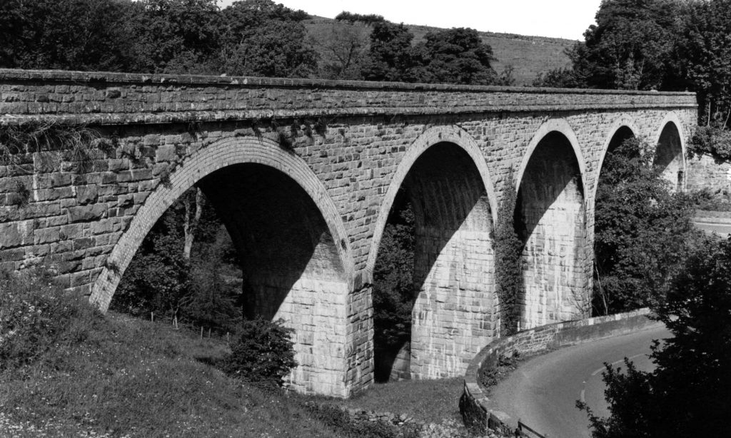
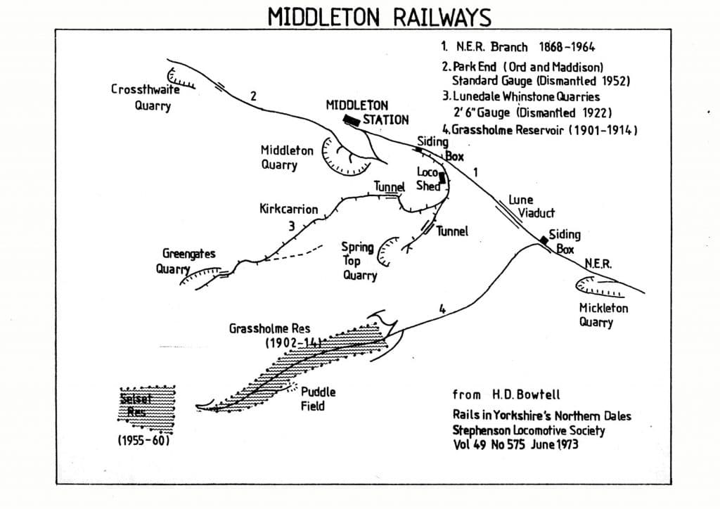
Originally planned to run all the way to Alston, the line from Barnard Castle to Middleton-in-Teesdale opened in 1868, coming over the Tees at Barnard Castle and stopping at Cotherstone, Romaldkirk and Mickleton. The line included two large viaducts, crossing the River Balder and the River Lune. It was operated by the North Eastern Railway and gave connections to Darlington, Bishop Auckland and Penrith.

Much of the traffic was stone from the quarries near Middleton and Mickleton. and some ore and livestock carriage. A narrow-gauge line linked to the quarries own track. A private siding served the London Lead Company timber works, where props were made for the mines. In 1894 the local co-operative society opened a siding for its coal and warehouse supplies. A 4-mile narrow gauge railway opened in 1914 to carry workers to the Grassholme reservoir. In 1922 five trains a day ran each way during the week. It took just 18 minutes to travel from Middleton to Barnard Castle and 53 minutes to Darlington.

Steam trains were replaced by diesel in 1957. Five years later the line was one of the victims of the government’s cutback. The last passengers rode the train on 30 November 1964 and freight stopped in 1965. The remains of the station house are in Dale View Caravan Park, though badly damaged by fire in 2017.

Nick Catford’s excellent Disused Stations Website contains a wealth of knowldege about the former Middleton-in-Teesdale Railway line including this remarkable video showing a journey on the line in 1963


